ActiMap
Mod Info
- Full Version
Description
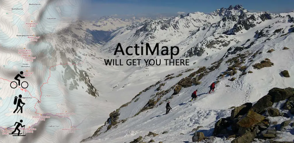
Designed for use in the great outdoors as a GPS and navigation aid, ActiMap is your best companion for outdoor and backcountry activities such as hiking, cycling, mountain biking, ski touring, and most things except caving…
ActiMap comes with a small starter library of online maps (map sources) pre-installed, and with the ability to easily add your own from the ActiMap online map sources library, or manually. The starter library includes:
~ OpenTopoMap: European topographic outdoor maps with contours and hill-shading based on OpenStreetMap data
~ HikeBikeMap: Worldwide hike and bike maps based on OpenStreetMap data
~ OpenCycleMap: The OpenStreet cycle map
~ ArcGIS World Topo map: Land cover and World topographic maps from various sources hosted by Esri
With a focus on selected National topographic maps which are not based on OpenStreetMap data, the online map sources library currently includes those for Austria, Belgium, Canada, France, Germany, Great Britain, Italy, New Zealand, and Norway, Spain, and the United States. These include:
~ Kompass: National topographic maps of Austria and Germany
~ Norwegian Mapping Authority: National topographic maps of Norway
~ UK Ordnance Survey Landranger and Explorer type outdoor maps from Bing (*)
~ IGN: Topographic maps of France from géoportail
~ USGS topographic maps at 1:100000 and 1:24000 of the USA
You will also find World satellite imagery. This library will be updated regularly, and you can start importing it straight away. Be sure to keep coming back!
Regions of maps can be downloaded for use offline, and you can record and display tracks of your journeys.
Look at these other features:
~ Simple interface design specifically for use on the go
~ One tap control of track recording
~ Real-time altitude profile of your current track
~ Add named waypoints to your current track
~ Real-time current location, heading, and track display
~ Compass with both magnetic and true-North bearings
~ Mini-compass display on the map
~ Low battery usage
~ Download multiple maps simultaneously
~ Pause and resume map downloads
~ Import, export, and share downloaded maps
~ Import, export, and share GPX files
~ Import, export, and share online map source definitions
~ Import and view Garmin Training Center (TCX) tracks
~ Manually add and edit map sources
~ Display multiple tracks and routes in different colors
~ Display points of interest and waypoints
~ Smooth map scrolling
~ Smooth zooming, not limited to fixed zoom levels
~ Map scaling for easier reading of small map fonts
~ Embedded help guide for use offline
~ Note: The ActiMap user interface is currently in English and German (BETA) only
Note: When purchasing ActiMap, you are only purchasing the functionality the app provides, and not a license to use the mapping data. The usage and licensing rights of the maps (and potentially of downloaded GPX tracks) you access are the property of their providers, and you are kindly asked to honor them. All online maps in the starter library and the ActiMap online library are also publicly accessible online for free via their respective websites.
(*) Bing Maps, while publicly accessible at bing.com/maps, requires a key for access within an app such as ActiMap. The embedded ActiMap key is a basic limited-use key. As such, permanent ongoing free access to Bing Maps is not guaranteed and will be reviewed based on usage.
Act Now! Get The Outdoor Map App You Need – ActiMap!
Images


Related apps


Recent Updates
-
Updated
 Stickman: Draw Animation Maker MOD APK (Premium Unlocked)6.2.2s Appache apps and games ltd 50 MB
 -
UpdatedMedisafe MOD APK (Premium Unlocked)9.50.3 Medisafe® 44 MB
-
UpdatedSense Flip Clock & Weather MOD APK (Premium Unlocked)9.10.0 MACHAPP Software Ltd 150 MB
-
UpdatedTransparency Icon Pack APK (Full Version)6.7 PizzApp Design 45 MB
-
UpdatedPhoto Editor MOD APK (Ad-Free Unlocked)13.3.1 dev.macgyver 10 MB
-
Most Downloaded Apps
-
UpdatedSpotify MOD APK (Premium Unlocked)9.1.52.1394 Spotify AB 100 MB
-
YouTube MOD APK (Premium Unlocked)21.21.80 Google LLC 110 MB
-
UpdatedYouTube Vanced MOD APK (Premium Unlocked, No Ads)21.21.91 Vanced Team 120 MB
-
UpdatedTikTok MOD APK (Premium, All Region Unlocked)45.3.5 TikTok PTE.ltd. 200 MB
-
UpdatedHOT51 PRO MOD APK (VIP/Room Unlocked, No Ads)1.1.999-93 HOT51 60 MB
-
Most Downloaded Games
-
UpdatedHiggs Games Island MOD APK (X8 Speeder, No Password)2.78 Higgs Games 200 MB
-
GTA 5 Unity APK (Latest)0.7 Rockstar Games 1.4 GB
-
Royal Dream MOD APK (X8 Speeder, No Ads)6.29 HIGOGAME PTE LTD 130 MB
-
Grand Theft Auto: San Andreas MOD APK (Unlimited Money)2.11.311 Rockstar Games 2.5 GB
-
UpdatedRoblox MOD APK (Mega Menu, 60+ Features)2.723.787 Roblox Corporation 200 MB
-


