
GPS Test

Images


Description
GPS Test MOD APK provides detailed GPS and GNSS information, satellite tracking, compass, altitude, speed, coordinates, UTC time, and location data on Android devices.
GPS Test MOD APK – GPS Signal, Satellite, Compass & Navigation Tools
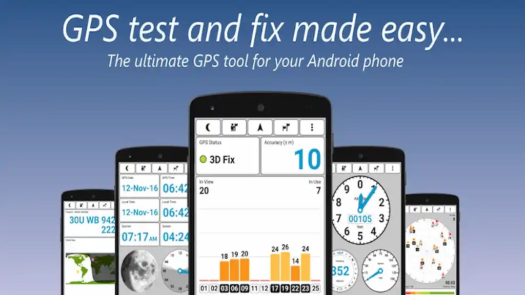
GPS Test MOD APK turns your Android device into a practical GPS and GNSS information tool for checking satellite reception and monitoring important positioning data. The app helps you see how well your device receives GPS signals while also providing detailed information about satellites, location, altitude, speed, direction, and time.
Beyond basic GPS monitoring, GPS Test provides several useful tools in one interface. You can check satellite signal strength, view satellite positions, monitor your current coordinates, use the built-in compass, and compare GPS time with your local time. The application also supports multiple global satellite navigation systems, making it useful for users who want more detailed information about their device’s positioning performance.
Check GPS Signal Strength
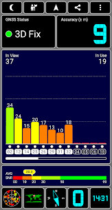
GPS Test displays the signal strength of individual satellites through an easy-to-understand SNR bar chart. This allows you to see which satellites your device currently detects and how strong their signals are.
The application also shows information about the accuracy and current status of the GNSS network. These details can help you determine whether your device has a strong enough satellite connection for reliable positioning or whether you need to move to an area with better reception.
Support for Multiple Satellite Systems
GPS Test supports several satellite navigation networks, including GPS, GLONASS, GALILEO, SBAS, BEIDOU, and QZSS. Supporting multiple systems allows compatible devices to gather positioning information from different satellite constellations.
This can provide a more comprehensive overview of the satellite signals available around you. The exact satellites and systems detected will depend on your device hardware and the satellite networks available in your location.
Satellite Sky View
The Sky View screen displays the positions of detected satellites in the sky using a rotating compass-style interface. This visual representation makes it easier to understand where satellites are located relative to your current position.
You can use this screen to monitor the satellites your device detects and get a clearer picture of the current GNSS environment. The rotating display also makes the information easier to interpret while you change your viewing direction.
View Your Current Location
GPS Test shows your current location using both text information and a world map. This gives you a straightforward way to check your geographical position while monitoring additional location-related information.
The location screen also displays the current position of the sun and the day-and-night transition curve. These features provide useful environmental information alongside your GPS position, especially when you want to understand daylight conditions at your current location.
Built-In Compass
The application includes a dedicated compass screen that displays your current heading. This provides a convenient way to determine direction without switching to a separate compass application.
The compass can also work alongside the satellite and location information, giving you several important navigation-related measurements within the same application.
Monitor Speed, Heading & Altitude
GPS Test can display your current speed, heading, and altitude as text. These measurements can be useful when traveling, hiking, driving, cycling, or simply testing the positioning capabilities of your smartphone.
Altitude information is particularly useful for users who want to monitor elevation changes, while speed and heading provide additional context about current movement and direction.
Accurate GPS and Local Time
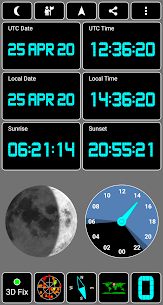
GPS Test can display the current time received from GPS satellites alongside the local time in your current time zone. It also provides sunrise and sunset information based on your location.
Having access to GPS-based time can be useful when you want to compare satellite time with your device’s local clock. The sunrise and sunset data adds another practical feature for outdoor activities and location monitoring.
Coordinate Grid Support
GPS Test supports several coordinate grid systems for users who require more specialized geographical information. Supported systems include OSGB, UTM, MGRS, USNG, CH1903, and Maidenhead.
These coordinate formats can be useful for different navigation, mapping, surveying, geographic, and amateur radio applications. The availability of detailed coordinate information makes GPS Test more versatile than a basic GPS status application.
Multiple Map Datums
The app also supports a range of geographical datums, including WGS84, NAD83, NAD27, ED50, AGD66, AGD84, and SAD69, along with additional supported datums.
Datum support gives users more flexibility when working with coordinate systems and geographic data that rely on different reference models. This can be especially useful for users who need more precise geographical information.
Customizable Color Schemes
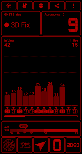
GPS Test offers multiple color schemes that allow you to customize the appearance of the interface. You can select a style that matches your preferences or use the available night mode when viewing the application in darker environments.
The color schemes can also help the app match other instruments or equipment you use alongside your Android device, making the interface more suitable for different workflows.
Works on Phones and Tablets
GPS Test supports a wide range of screen resolutions, from smartphones to larger Android tablets. This makes the application flexible for users with different types of devices.
The larger display of a tablet can also make satellite charts, maps, and other detailed GPS information easier to view, while smartphones provide a more portable solution for outdoor activities and travel.
GPS Test Plus Features
Users who want additional functionality can explore GPS Test Plus, which expands the basic GPS monitoring experience with several extra tools. Enhanced features include simple navigation, location sharing through services such as email and SMS, and additional dial-style displays for altitude, speed, and compass information.
GPS Test Plus also includes a seven-segment LED font, a dot-matrix font, and a HUD mode. These options provide alternative ways to display information and can make the application more suitable for users who prefer a dedicated instrument-style interface.
Works Without an Internet Connection
GPS Test does not require a Wi-Fi or mobile data connection to provide its core GPS functionality. Internet permissions are used for analytics and advertising, while the application can continue working without an active internet connection.
This makes GPS Test useful in situations where mobile connectivity is unavailable, such as remote outdoor areas, hiking trails, or locations with weak cellular coverage. As long as your device can receive the required satellite signals, you can continue checking GPS information without relying on an internet connection.
Why Use GPS Test MOD APK?
GPS Test MOD APK offers a convenient way to access detailed GPS and GNSS information from a single Android application. Instead of using separate tools for satellite reception, compass direction, altitude, speed, coordinates, and GPS time, you can monitor these measurements from one interface.
Its support for multiple satellite systems, coordinate grids, map datums, customizable themes, and offline operation makes it suitable for a wide range of users. Whether you are troubleshooting GPS reception, checking satellite signals, monitoring your position, or exploring navigation data, GPS Test provides the necessary information in an accessible format.
Final Verdict
GPS Test MOD APK is a comprehensive GPS monitoring and navigation utility for Android users who want more information than a standard location application provides. It combines satellite signal monitoring, Sky View, compass, altitude, speed, heading, GPS time, sunrise and sunset information, coordinate systems, and multiple GNSS networks in one application.
With support for GPS, GLONASS, GALILEO, SBAS, BEIDOU, and QZSS, along with multiple coordinate grids and datums, GPS Test can serve both casual users and those who need more detailed positioning data. Its customizable interface and ability to work without Wi-Fi or mobile data further improve its practicality for everyday use and outdoor activities.
Note: Some GPS, GNSS, sensor, satellite, and recording-related capabilities depend on the hardware and sensors available on your Android device.
Related apps


Latest Apps
-
 My Talking Tom Friends26.5.10.25510 Outfit7 Limited 182.33 MB Unlimited Money
 -
 Going Balls3.44 Supersonic Studios LTD 207.44 MB Unlimited Coins
 -
 Dominoes2.7.0 Loop Games 221.73 MB Unlimited Coins
 -
 MadOut2 BigCityOnline21.20 MadOut Games LLC FZ 1413.63 MB Unlimited Ammo
 -
 RFS – Real Flight Simulator4.0.0 RORTOS 441.33 MB Full Game
-