MapCam – Geo Camera & Collages
mod info
- Pro features unlocked | Map works
Description
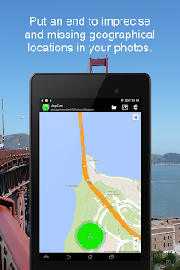
MapCam is a camera app that helps you capture photos with accurate geographical location data. It prevents your photos from having imprecise or missing GPS positions.
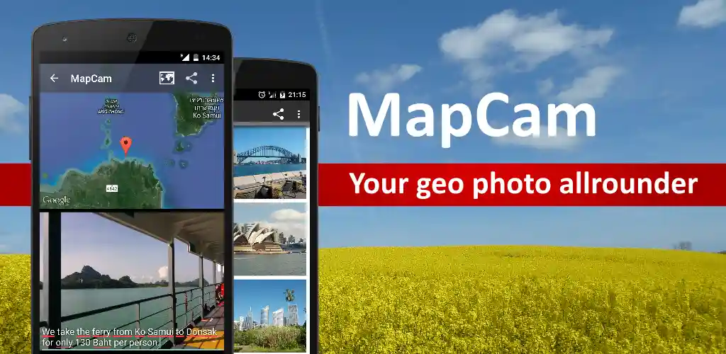
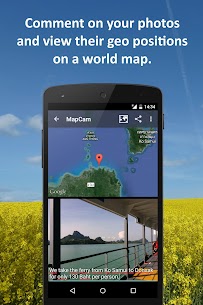
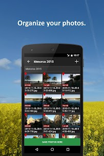
Plan and sort your pictures in advance by simply choosing a folder where you want to save them. Put words under your pictures to explain what they are. See where your photos were taken on a map of the world. Make cool pictures by putting together photos of places and share them with your friends.
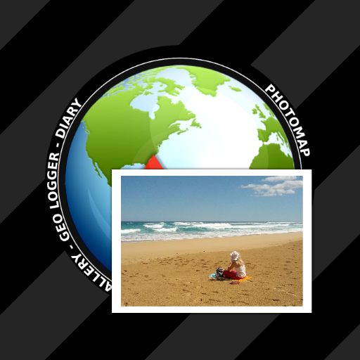
To do all this, MapCam works together with your favorite camera app and stores additional meta data in your photo files. This enables you for instance to view your pictures and photo captions on a world map at the places where you took them (see my apps EagleEye and PhotoMap). In this way, you can go on a trip again by jumping virtually from location to location.
MapCam offers you the following functions:
✔ Easily create and select storage folders for your photos before taking them.
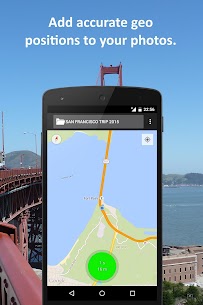
✔ Automatic storage of the best available degrees of latitude/longitude and altitude (in metres above sea level) in the Exif data of your photo files.
✔ Add a descriptive text resp. photo caption to your pictures. The text is saved in the IPTC metadata of your photo file and does not change your photo. Picasa is able to read and show these descriptions on your PC.
✔ Create geo photo collages (map and photos).
✔ Share your photos just after taking them, e.g. via e-Mail, Facebook, Flickr, Google+, Instagram, MMS, Picasa, Skype, Twitter, WhatsApp, Dropbox etc.
✔ Use existing camera apps. Many apps are compatible, e.g. the most preinstalled ones, Camera MX, Cymera, LINE camera, pudding camera, Camera FV-5 Lite, Camera360 Ultimate etc.
Using MapCam is simple:
1. Click the round button as soon as you are happy with the detected position. The button is light green and big when the current position is precise. It is red and small when the position is imprecise.
2. Take your picture: MapCam starts the default camera app or your selected one and stores the best available position in the Exif data of your photo file.
3. Add a descriptive text and share your photo (optional).
Use MapCam if the position and description of photos is important to you. Here are some examples:
★ When traveling, on vacation, on business trips, when camping, at the beach, at the airport, at the train station, at the museum, etc.
★ Make a note of sites such as real estate, homes, cars, hotels, hostels, restaurants, places of work, schools, parking lots, etc.
★ During sport such as bicycling, rowing, running, jogging, skiing, snowboarding, hiking, exercising, playing football, etc.
★ As a spectator at a special event such as a concert, a festival, a soccer game, a tennis match, etc.
★ As a visitor to a park, flea markets, zoos, amusement parks, Christmas markets, etc.
★ On the weekend family outing, at a party/celebration, at a bar/nightclub, in a club, to record the night life etc.
★ When meeting with friends at the mall, on the playground, while shopping, in a restaurant, etc.
★ On special occasions such as birthdays, weddings, celebrations, parades, etc.
★ In the event of a disaster such as an earthquake, storm surge, flood, tsunami, storm, hurricane, forest fire, etc.
MapCam is interesting for the following occupational groups: real estate brokers, dealers, craftsmen, firefighters, police officers, construction workers, drivers (truck drivers, taxi drivers), event managers, foresters, gardeners, janitors, pilots, soldiers, etc.
Images

Related apps


Recent Updates
-
Updated
 Car Eats Car 3 MOD APK (Unlimited Money/Gasoline)4.2.0 SMOKOKO LTD 150 MB
 -
UpdatedHill Climb Racing MOD APK (Unlimited Money)1.69.2 Fingersoft 100 MB
-
UpdatedTacticool MOD APK (Mega Menu, Dumb Enemies)2.14.0 Panzerdog 800 MB
-
UpdatedWEBTOON MOD APK (Screenshots, Coins, No Ads)3.9.4 NAVER WEBTOON 74 MB
-
UpdatedMadOut 2 MOD APK (Mega Menu, Fly, Speed)19.57 MadOut Games LLC FZ 1.4 GB
-
Most Downloaded Apps
-
UpdatedSpotify MOD APK (Premium Unlocked)9.1.52.1394 Spotify AB 100 MB
-
UpdatedYouTube MOD APK (Premium Unlocked)21.21.80 Google LLC 110 MB
-
UpdatedYouTube Vanced MOD APK (Premium Unlocked, No Ads)21.21.91 Vanced Team 120 MB
-
UpdatedTikTok MOD APK (Premium, All Region Unlocked)45.3.5 TikTok PTE.ltd. 200 MB
-
UpdatedHOT51 PRO MOD APK (VIP/Room Unlocked, No Ads)1.1.999-93 HOT51 60 MB
-
Most Downloaded Games
-
Higgs Games Island MOD APK (X8 Speeder, No Password)2.77 Higgs Games 200 MB
-
GTA 5 Unity APK (Latest)0.7 Rockstar Games 1.4 GB
-
Royal Dream MOD APK (X8 Speeder, No Ads)6.29 HIGOGAME PTE LTD 130 MB
-
Grand Theft Auto: San Andreas MOD APK (Unlimited Money)2.11.311 Rockstar Games 2.5 GB
-
UpdatedRoblox MOD APK (Mega Menu, 60+ Features)2.721.1108 Roblox Corporation 200 MB
-


