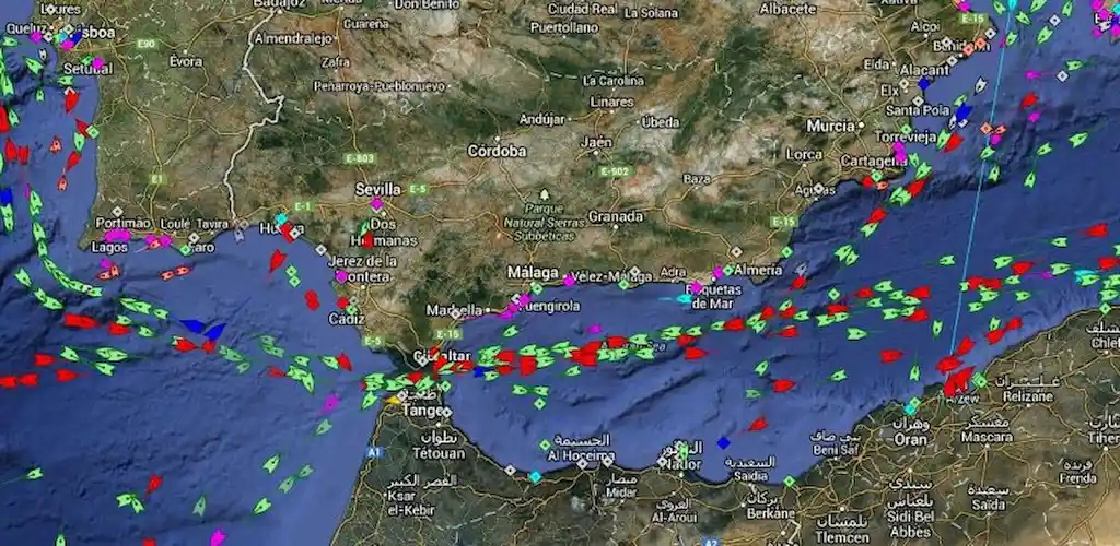
MarineTraffic – Ship Tracking displays near real-time positions of ships and yachts worldwide. Connected to the largest network of land-based AIS receivers, the app covers most major ports and shipping routes.
MarineTraffic – Ship Tracking: A Comprehensive Overview
MarineTraffic – Ship Tracking offers a sophisticated system to view near real-time positions of ships and yachts worldwide. This app is connected to the largest network of land-based AIS receivers, covering most major ports and shipping routes. Here’s a detailed breakdown of its features and capabilities.
Real-Time Vessel Tracking
Live Map Visualization
MarineTraffic allows users to view vessels on a live map, search for specific ships, boats, and seaports, and see nearby maritime activity. This feature provides a comprehensive view of shipping traffic, making it easier to monitor and track vessels in real-time.
Vessel Tracking
Every day, more than 100,000 vessels report their positions through MarineTraffic AIS. This extensive network ensures that users have access to up-to-date information about ship locations, enhancing maritime awareness.
Weather and Wind Forecasts
Live Wind and Forecasts
MarineTraffic integrates live wind data and 48-hour wind forecasts into the map. This feature is crucial for navigation and planning, helping users anticipate weather conditions and make informed decisions.
Vessel Track Playback
Animated Playback
The app offers animated playback of a vessel’s track, allowing users to review the path a ship has taken. This feature is useful for analyzing routes, understanding shipping patterns, and conducting post-voyage assessments.
Port Information
Port Arrivals and Departures
MarineTraffic provides live updates on port arrivals and departures for over 4,000 ports and marinas. Users can view current conditions in ports and get estimated times of arrival for boats and ships, ensuring they stay informed about port activities.
Fleet Management
My Fleet
Users can manage their list of vessels through the “My Fleet” feature. This list is shared across all devices and MarineTraffic.com, enabling seamless access and management of tracked vessels.
Extensive Photo Database
Ship and Harbor Photos
MarineTraffic boasts a collection of 2.5 million photos of ships, harbors, lighthouses, and more. This extensive visual database enriches the user experience, providing detailed imagery of maritime assets.
Advanced Tracking Capabilities
Satellite Tracking with ACCESS PLUS 24
MarineTraffic extends its tracking capabilities beyond the range of land-based AIS receiving stations through satellite tracking, available with an in-app purchase of ACCESS PLUS 24. This feature ensures that users can identify and track vessels even in remote areas.
Augmented Reality Tool
Vessel Identification
The app includes an Augmented Reality tool that allows users to identify vessels around them at a glance. By pointing their device’s camera to the horizon, users can get detailed information about nearby vessels, including name, flag, speed, and distance.
Conclusion
MarineTraffic – Ship Tracking is an advanced maritime tracking app that offers a range of features to monitor and manage vessel movements. From real-time tracking and wind forecasts to port arrivals, fleet management, and augmented reality identification, MarineTraffic provides comprehensive tools for maritime enthusiasts, professionals, and organizations. With its extensive network and advanced capabilities, MarineTraffic stands out as a valuable resource for anyone involved in the maritime industry.


