Measure Map MOD APK (Premium Unlocked)
Mod Info
Premium / Paid features Unlocked
Description
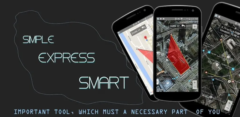
Measure Map Mod APK is an application support distance calculator to find out the distance between two or more points anywhere on the earth.

Discover Measure Map: Your Ultimate Distance and Area Calculator
Are you in need of a reliable tool to measure distances and areas on Earth? Look no further than Measure Map, an innovative application designed to simplify your geographical measurements. Whether you’re planning a trip, conducting a survey, or just curious about the distance between two points, Measure Map has got you covered.
How Does Measure Map Work?
Simple Point-to-Point Distance Measurement
To start measuring, simply:
- Click once on the map to set your starting point (Point A).
- Click again to place your destination point (Point B).
Measure Map instantly calculates and displays the distance between these points. It’s that easy!
Measuring Total Distance Over Multiple Points
For more complex routes or areas:
- Add multiple markers by continuing to click on the map. This feature allows you to calculate the total distance along a series of points, perfect for trip planning or route mapping.
Advanced Features for Precision
Adjusting Marker Positions
If you need to adjust your markers:
- Hold and drag any marker for three seconds to reposition it directly on the map.
- Alternatively, use the Clipboard button located at the bottom-right corner of the screen. Here, you can edit and move markers with precision.
Versatile Measurement Units
Measure Map supports a variety of units to cater to different preferences and needs:
- Distance: Meters, kilometers, nautical miles, feet, miles, and yards.
- Area: Square meters, square kilometers, square feet, square nautical miles, square yards, acres, and hectares.
Enhanced Map Viewing Options
Switch Map Types
- Normal: Standard map view.
- Satellite: High-resolution satellite imagery.
- Terrain: Topographic details for elevation and landforms.
- Hybrid: A mix of satellite imagery with road maps for detailed navigation.
Sharing and Collaboration
Share Your Coordinates
- Easily share your current location coordinates with others directly from the app.
Import and Export Data
- Import/Export markers using KML, KMZ, or CSV files, making it seamless to share or transfer data with other platforms or team members.
Additional Features
- UTM and MGRS Coordinates: For users requiring military grid reference system or universal transverse mercator coordinates, Measure Map provides these advanced options.
Why Choose Measure Map?
- User-Friendly Interface: Designed for ease of use, making geographical measurements accessible to everyone.
- Precision and Flexibility: With the ability to adjust markers and choose from various measurement units, Measure Map ensures accuracy in all your calculations.
- Versatile Application: Whether for professional surveying, academic research, or personal curiosity, this app fits all needs.
Conclusion
Measure Map stands out as a versatile, user-friendly tool for anyone needing to measure distances or areas on Earth. Its integration of multiple map views, unit conversions, and data sharing capabilities make it an essential app for both casual users and professionals. Download Measure Map today and experience the ease of precise geographical measurements at your fingertips.


